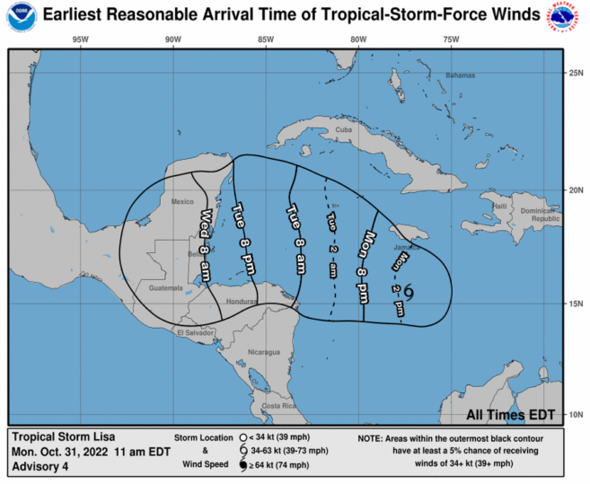
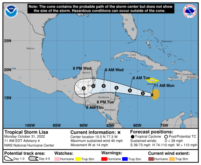
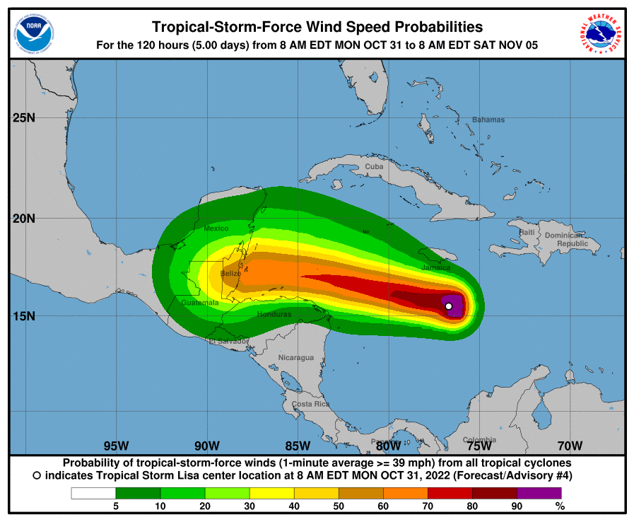
The National Meteorological Service of Belize and the National Emergency Management Organization (NEMO) hereby inform the public that at 10:00 a.m. (local time), Tropical Storm Lisa was located near latitude 15.5N, longitude 77.3W or about 735 miles East by South of Belize City. Lisa was moving to the west at 12 mph with maximum sustained winds of 40 mph and a minimum central pressure of 1003 mb. Lisa is to continue on a general west to west-north-westward track for the next few days. On this forecast path, the system will move south of Jamaica today, north of the northern coast of Honduras on Tuesday, and then approach the coast of Belize late Wednesday with landfall possible on Belize late on Wednesday night or early Thursday morning. Strengthening is expected and Lisa is expected to be a category 1 hurricane by landfall on the country.
This system will bring heavy rainfall to the country starting on Wednesday and continuing through Thursday which will result in flooding across low-lying and flood-prone areas of the country as the ground is already saturated. Daily rainfall totals of 2 to 4 inches with locally higher amounts are likely. Winds of category 1 hurricane strength of 74-95 mph are expected near the landfall location with a storm surge of 3-5 feet to the north of where the centre makes landfall.
NEMO advises the public to:
1. Put your family/emergency plan into action, check your emergency food, water and medical supplies. Check on the elderly and persons with disabilities.
2. Make early preparations to leave high-risk areas; voluntarily relocate to a safe location before the system makes landfall if you live in a low-lying area or vulnerable coastal community. Know which shelter you will go to.
3. Secure your home and your important documents. Secure loose objects and flammable material.
4. Municipalities and the public are advised to clear drains to reduce flooding.
Tropical systems can cause large tree branches to break and be uprooted. Damage to power lines will result in power outages that could last a few to several days, which may affect the water supply. Sewage system failure is likely. Falling debris could strike people, livestock, and pets. Protected windows will generally make it through a hurricane without major damage. Low-lying escape routes inland will be cut off by rising water 3 to 5 hours before landfall, and a flat terrain 5 feet or less above sea level can be flooded up to 8 or more miles inland.
Residents are advised to continue monitoring this system very closely and to follow official information coming from NEMO and the National Meteorological Service. Countrywide, all NEMO district emergency operations centers are to be activated by 6:00 p.m.
NEMO’s emergency hotline is 936 (NEMO Offices countrywide contact information is attached, to be read to the public). Stay alert, be prepared. Stay tuned for the National Met Service weather bulletins and the NEMO advisories.

Share
Read more

