From www.wunderground.com
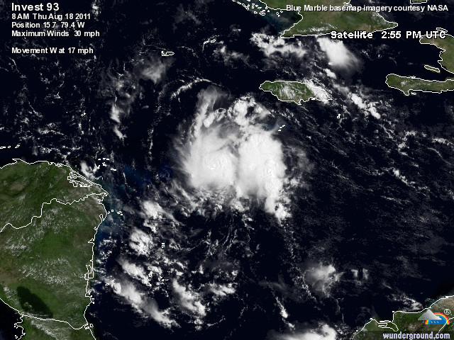
A westward-moving tropical wave in the Central Caribbean a few hundred miles south-southwest of Jamaica, Invest 93L, has continued to increase in organization, and is close to tropical depression status. 93L is a small system, but has built up a respectable area of heavy thunderstorms around its center. A few low-level spiral bands are apparent on satellite imagery, but there is almost no upper-level outflow apparent, and a surface circulation is not obvious. 93L has moistened its environment somewhat over the past day, but dry air is still in evidence around the storm, particularly to the southeast, as seen on water vapor satellite images. Wind shear continues to be low, 5 – 10 knots. There is a hurricane hunter mission scheduled for this afternoon at 2pm EDT to see if a tropical depression is forming.
Figure 1. Morning satellite image of 93L.
Heavy rains from 93L will begin spreading over Northern Honduras and Northeast Nicaragua tonight. The forward motion of 93L will slow to 5 – 10 mph by Friday, so the storm could be a major rain event for Northern Honduras, with rain amounts of 4 – 8 inches likely by the time the storm reaches Belize on Saturday. Heavy rains will spread to Belize and Mexico’s Yucatan Peninsula by Friday night or Saturday morning. The latest SHIPS model forecast shows wind shear remaining in the low range and the atmosphere steadily moistening over the next two days, which should allow 93L to reach tropical storm strength. All of the models agree that the ridge of high pressure steering 93L to the west will remain strong, forcing the storm into a landfall Friday in Northeast Honduras, or Saturday near the Belize/Mexico border. It is possible that 93L will have time to intensify into a Category 1 hurricane before then, though landfall as a tropical storm would be more likely, given the dry air that 93L needs to overcome, and the possibility that the storm will pass too close to the northern coast of Honduras. Regardless, heavy rain will be a major threat from 93L. NHC gave 93L an 80% chance of developing into a tropical depression by Saturday morning in their 8am outlook. If 93L does cross the Yucatan Peninsula and enters the Gulf of Mexico, a strong ridge of high pressure should keep the storm moving due west to make a second landfall along the Mexican coast, well south of Texas…MORE


